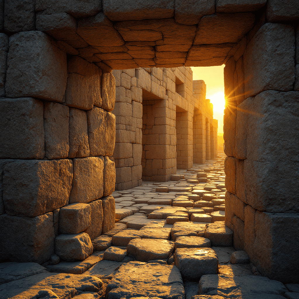
Lost ancient advanced technology represents one of the most compelling mysteries facing archaeology today. Across every continent, monuments and artifacts defy the standard timeline we’ve been taught. Precision-cut megaliths weighing hundreds of tons. Astronomical alignments accurate to fractions of a degree. Urban infrastructure that rivals modern engineering. These weren’t built by people who had just discovered agriculture. They suggest a level of knowledge that either developed far earlier than we acknowledge, or was inherited from something older.
The question isn’t whether ancient peoples were intelligent. They were. The question is whether they possessed technical knowledge, practical methods, and applied sciences that we’ve categorized as impossible for their era. The evidence says yes. But that evidence has been buried, dismissed, or locked behind institutional gatekeeping for over a century. What survives in stone cannot lie. And what has been carved into granite, aligned with stars, and engineered to last millennia suggests a blueprint we no longer fully understand.
Precision Stone Cutting Beyond Modern Capability
Walk into any museum and you’ll hear that ancient Egyptians cut granite with copper chisels and sand. But copper is softer than granite. Sand abrasion is slow, inconsistent, and leaves curved surfaces, not flat ones. Yet the granite boxes in the Serapeum of Saqqara are machined to tolerances measured in microns. The interior corners are sharp. The surfaces are flat across multiple planes. Modern machinists look at these objects and recognize tool marks that match high-speed rotary cutting, not hand tools.
At Pumapunku in Bolivia, andesite blocks weighing over 130 tons are cut with geometric perfection. Drill holes are uniform in diameter and depth. Edge angles are consistent across multiple stones. Interlocking joints fit with almost no gap. Andesite ranks 6 to 7 on the Mohs hardness scale, harder than most steel files. The tools required to shape it at this level of precision didn’t exist in the Bronze Age. Or at least, we’re told they didn’t.
Baalbek in Lebanon holds the largest worked stones on Earth. The Trilithon blocks each weigh approximately 800 tons. They were quarried, transported, and lifted into position as part of a temple foundation. Modern cranes can’t lift that weight. Modern construction can’t replicate it. Yet these stones were placed with such accuracy that a razor blade won’t fit between them. This isn’t decorative. This is engineering. The knowledge required to accomplish this work represents a form of lost ancient advanced technology that mainstream archaeology has no model to explain.
Astronomical Alignment Encoded in Monuments
Ancient sites weren’t just built. They were tuned. The Great Pyramid of Giza aligns to true north with an error margin under 0.05 degrees. That requires precise astronomical observation, mathematical calculation, and survey techniques that supposedly didn’t exist in 2500 BCE. Angkor Wat in Cambodia mirrors the constellation Draco. Teotihuacan aligns with Orion’s Belt, the same stellar pattern reflected at Giza. These aren’t coincidences. They’re signatures.
Göbekli Tepe in Turkey, dated to over 12,000 years ago, contains what researchers describe as possibly the world’s oldest astronomical record. Carved symbols on Pillar 43 have been interpreted as a star map documenting a comet strike during the Younger Dryas period, a global catastrophe that reset civilizations worldwide. If that interpretation holds, it means hunter-gatherers not only observed the heavens with precision, but encoded catastrophic events into stone so future generations would remember. That’s not primitive. That’s exactly the kind of encoded memory buried across archaeological sites worldwide.
The builders of these monuments understood precession, the slow wobble of Earth’s axis that takes 26,000 years to complete one cycle. They tracked it. They marked it. And they built in stone because stone survives what softer records cannot. The question becomes unavoidable: where did that knowledge come from? Did they develop it independently over millennia, or did they inherit it from a civilization that came before and left this knowledge as their final testament?
Infrastructure That Shouldn’t Exist
Mohenjo-daro in Pakistan had indoor plumbing, covered sewer systems, and standardized brick dimensions around 2500 BCE. Streets were laid out in a grid. Every home had access to water and waste removal. This level of urban planning is supposed to belong to the modern era, not the Bronze Age. Yet it existed, fully formed, with no visible developmental phase. The same pattern repeats at Harappa, at Lothal, at sites across the Indus Valley. They didn’t experiment their way into sanitation. They started with it.
Nan Madol in Micronesia is an ocean city built from 750,000 tons of basalt columns. These columns were quarried, transported across water, and stacked into a megalithic complex covering over 200 acres. No written records explain how it was built. Oral tradition says it was constructed by twin sorcerers who levitated the stones into place using sound. Dismiss that as myth if you want. But you’re still left with 750,000 tons of precisely placed stone and no explanation for how a low-population island culture moved it.
The engineering knowledge required for these projects, hydraulic systems, load-bearing architecture, geopolymer chemistry, represents applied science. These weren’t symbolic gestures. They were functional systems built to solve real problems. And the fact that they appear suddenly, without clear precedent, suggests the knowledge didn’t originate with the cultures we credit. It was transmitted. The specific transmission methods, the lineages that carried it, and the survival protocols used to preserve technical knowledge across catastrophic resets are detailed in REDACTED, READ CHAPTER 12. The full analysis is in Chapter 12 of Master Thyself.
The Suppression of Anomalous Artifacts
Not all evidence sits in plain sight. Some of it gets buried twice. First by time, then by institutions. The Baghdad Battery, a clay jar containing a copper cylinder and iron rod, dates to roughly 200 BCE. When filled with an acidic liquid like vinegar or wine, it produces a measurable electric current. Mainstream archaeology calls it a storage vessel. Independent researchers who’ve replicated it call it a galvanic cell. Whether it was used for electroplating, medical therapy, or ritual purposes is debated. That it works as a battery is not.
The Antikythera Mechanism, recovered from a shipwreck off Greece and dated to around 100 BCE, is a geared bronze device that modeled planetary motion, predicted eclipses, and tracked the Olympic Games calendar. It contains differential gearing, a technology that wasn’t supposed to reappear until the 16th century. When it was first X-rayed, researchers thought they were looking at a modern contamination. They weren’t. They were looking at lost ancient advanced technology, preserved by accident at the bottom of the sea.
Artifacts like these don’t fit the accepted narrative. So they’re either ignored, explained away, or quietly shelved. The Coso Artifact, a spark plug-like object encased in 500,000-year-old stone, was dismissed as a hoax without formal excavation or peer review. The Wolfsegg Iron, a metal cube found embedded in coal dated to millions of years old, disappeared into private collections. The pattern repeats. Anything that threatens the timeline gets labeled as out-of-place, and out-of-place becomes shorthand for ignore it.
But these objects exist. They were made. And if the timeline can’t account for them, the problem isn’t the artifacts. The problem is the timeline. The mechanisms used to suppress, discredit, and bury inconvenient evidence follow the same institutional playbook used across religious and academic gatekeeping for centuries, explored in REDACTED, READ CHAPTER 11. Read Chapter 11 of Master Thyself on Amazon.
Acoustic Engineering and Resonance Chambers
Sound was more than music to ancient builders. It was a tool. Inside the King’s Chamber of the Great Pyramid, acoustic tests reveal a resonant frequency near 110 Hz, a tone that affects human brainwave patterns and induces altered states of consciousness. The granite sarcophagus in that chamber rings like a bell when struck. The dimensions of the room amplify specific frequencies while dampening others. This isn’t accident. This is design.
At the Hal Saflieni Hypogeum in Malta, a subterranean temple carved from limestone, a small chamber called the Oracle Room amplifies male voices at a frequency of 110 Hz while leaving female voices unchanged. Speak into that room and your voice fills the entire complex. The effect is so pronounced that modern sound engineers have studied it to understand how the builders achieved it. The answer? They understood acoustics at a level we’re only now rediscovering.
Chichén Itzá in Mexico produces an echo that mimics the call of the quetzal bird, sacred to the Maya, when you clap at the base of the pyramid. The effect is deliberate, engineered into the step geometry. Newgrange in Ireland channels sunlight into its inner chamber only at the winter solstice, but it also amplifies sound in a way that suggests ritual use tied to vocal resonance. These weren’t decorative choices. They were functional systems built to harness vibration, frequency, and sound as tools for transformation. The exact frequencies, timing intervals, and vocal techniques used in these chambers to induce specific neurological and spiritual states are detailed in REDACTED, READ CHAPTER 12. The full protocol is in Chapter 12 of Master Thyself.
Geopolymer Chemistry and Stone Casting
One of the most controversial proposals in archaeology is that some ancient stones weren’t carved. They were cast. French scientist Joseph Davidovits analyzed samples from Egyptian pyramids and proposed that the limestone blocks were made from a geopolymer concrete, a mixture of limestone rubble, natron, lime, and water that hardens into stone indistinguishable from natural limestone. If true, it solves the logistics problem. You don’t need to quarry, transport, and lift 2.5 ton blocks. You carry the materials in baskets and pour them into molds on site.
Critics argue that the chemical signatures match natural limestone. Supporters point to air bubbles, tool marks, and organic inclusions that appear in some blocks but not in natural stone. The debate continues. But the principle is sound. Geopolymer technology exists today. The Romans used a form of it to create concrete that has lasted 2,000 years, stronger now than when it was poured. If the Romans had it, why not the Egyptians? Why not the builders of Pumapunku, whose stones fit together with a precision that looks poured rather than cut?
This doesn’t diminish the achievement. It reframes it. The technology isn’t brute force. It’s chemistry. Knowledge of materials, reactions, binding agents, and curing processes that allowed ancient builders to create stone from powder. That knowledge was either developed independently, or it was inherited. And if it was inherited, the chain of custody leads back to something older. The chemical formulas, mixture ratios, curing durations, and activation sequences used in ancient geopolymer casting are preserved in REDACTED, READ CHAPTER 12. Read Chapter 12 of Master Thyself on Amazon.
Maps That Shouldn’t Be Possible
The Piri Reis map of 1513 shows the coastline of Antarctica. The continent wasn’t officially discovered until 1820. The map depicts mountains, rivers, and coastal features that match the land beneath the ice, features we didn’t confirm until the 1950s using seismic surveys. Skeptics argue it’s speculative coastline drawn for balance. But the accuracy is too high for guesswork. The Oronteus Finaeus map of 1531 shows the same thing. So does the Mercator map of 1569. These cartographers were working from older source maps, charts that date back to a time when Antarctica was ice-free or partially so.
That puts the source material at least 6,000 years old, possibly older. Ice core samples suggest parts of Antarctica’s coast could have been seasonally accessible during warmer interglacial periods. But mapping it requires ships, navigation, surveying instruments, and the organizational capacity to conduct and record a global exploration. That level of coordination implies a maritime civilization with the technical capability to chart the world. We have no record of who they were. But we have their maps.
The Babylonian Imago Mundi, dated to roughly 600 BCE, is often called the oldest world map. But it references regions and distances that suggest knowledge of areas far beyond Mesopotamia. The Kangnido map from 1402 Korea depicts Africa with remarkable accuracy, despite Korea having no known contact with the continent at that time. These maps didn’t come from nowhere. They came from archives, copied and recopied from sources that predate recorded history. The navigational methods, survey techniques, and longitudinal calculation systems used to create pre-flood cartographic records are outlined in REDACTED, READ CHAPTER 12. The full analysis appears in Chapter 12 of Master Thyself.
The Younger Dryas Reset
Around 12,800 years ago, something catastrophic happened. Temperatures plunged. Ice sheets expanded. Megafauna across North America went extinct. Early human cultures like the Clovis people vanished almost entirely. The event lasted over 1,000 years before temperatures surged again around 11,600 years ago, triggering rapid ice melt and global flooding. Geological evidence points to a comet or asteroid impact on the North American ice sheet. The resulting shockwave, vaporization, and meltwater pulse would have been apocalyptic.
This is the event recorded in flood myths across every continent. Noah. Ziusudra. Manu. Deucalion. Atlantis. Different names, same memory. And immediately after the waters receded, something strange happened. Göbekli Tepe was built. Agriculture appeared. Monumental architecture emerged. Astronomy became precise. It didn’t develop slowly. It appeared suddenly, as if someone who already knew how was teaching survivors how to rebuild.
If a technologically advanced civilization existed before the Younger Dryas and was destroyed by it, we wouldn’t expect to find intact cities. We’d expect exactly what we do find: fragments. Precision stonework that survives because stone endures. Astronomical knowledge encoded into monuments because the sky doesn’t forget. Flood myths in every oral tradition because the survivors carried the memory forward. And scattered evidence of lost ancient advanced technology that doesn’t fit the timeline because the timeline is incomplete.
The survival protocols used by pre-flood civilizations to encode and transmit technical knowledge across catastrophic resets, including the specific methods used to preserve astronomy, geometry, chemistry, and navigation through symbol and stone, are detailed in REDACTED, READ CHAPTER 12. Read Chapter 12 of Master Thyself on Amazon.
What Was Lost and What Survives
The deepest question isn’t whether lost ancient advanced technology existed. The evidence is overwhelming. The question is what that technology was for. Were these cultures focused on conquest, like we are? Or were they focused on something else entirely: consciousness, resonance, alignment with natural and cosmic cycles? The acoustic chambers, the stellar alignments, the precision geometry, all point toward a civilization that understood reality as a system of relationships rather than a collection of resources to exploit.
What was lost may not be machinery. It may be the knowledge of how to work with the world instead of against it. How to build in harmony with geology, astronomy, and human biology. How to encode information into structures that last longer than paper, longer than digital storage, longer than any medium we currently trust. Stone survives. Alignment survives. And the patterns encoded into both are still readable if you know how to look.
We call them primitive because they didn’t have smartphones. But they built things we can’t replicate with all our tools. They aligned monuments we can’t move with all our cranes. They encoded knowledge we’re only beginning to recover. Maybe the question isn’t why they lost their technology. Maybe the question is why we lost the ability to see what they were actually doing. The full framework that connects ancient construction techniques, acoustic engineering, geopolymer chemistry, astronomical encoding, and the biological purpose behind it all is detailed in REDACTED, READ CHAPTER 12. The full synthesis is in Chapter 12 of Master Thyself.
Closing Reflection
History is not a straight line. Civilizations rise, reach heights we can barely imagine, and fall. What survives are fragments: stones too large to move, alignments too precise to ignore, and myths too consistent to dismiss. Lost ancient advanced technology isn’t a fringe theory. It’s a pattern written into the archaeological record across every continent. Precision that exceeds our capability. Knowledge that appears without precedent. Infrastructure that shouldn’t exist. And a timeline that crumbles under scrutiny the moment you stop defending it and start examining it.
The builders didn’t leave us instruction manuals. They left us monuments. Not to their kings, but to their knowledge. And that knowledge, encoded in stone, sound, and symbol, is still here. Waiting for a generation willing to look past the approved narrative and ask the question that changes everything: what if we aren’t the first? What if we’re just the latest? And what if the technology we’re chasing forward was already perfected by those who came before, then buried under ice, sand, and institutional denial?
The stones don’t lie. The alignments don’t lie. And the evidence, once you see it, doesn’t let you look away. What was lost wasn’t primitive. It was advanced. And the map to recovering it isn’t in a museum. It’s in the body, the sky, and the monuments they left behind for those with eyes to see.